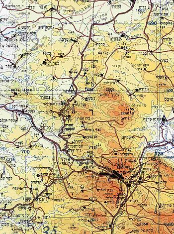
Map
A map is a graphical representation of the layout of the world (or part of the world). Cartography is the study of maps and the science of drawing maps.
Mapping and map reading are important skills in scouting - and a really handy skill to have in life.
Map orientation
It is very important to orientate the map correctly and then from this you can figure out where you are and where you need to head to. Ways to orientate the map include: using a compass to align to magnetic north - and to read bearings to key landmarks represented on the map.
If you are in the country, you should notice landmarks - that is, objects which help you to find your way or prevent you getting lost, such as distant hills, church towers, and nearer objects, such as peculiar buildings, trees, gates, rocks, etc. ~ Robert Baden-Powell
Parts of a map
Normally a map will have additional information together with the diagram.
Map Scale
Most maps are drawn to a scale that is expressed as a ratio, e.g. 1:50 000 or 1: 10 000
- This means 1 unit of measurement on the map corresponds to 50,000 of that same unit on the ground.
Understanding the map scale is important to be able to estimate distances.
The scale is accurate when the region mapped is small enough for the curvature of the Earth to be neglected, such as a topographical map. Mapping of larger regions, where the curvature cannot be ignored, requires projections to map from the curved surface of the Earth to the plane. The impossibility of flattening the sphere to the plane without distortion means that the map cannot have a constant scale.
Some map inaccuracies may be deliberate, cartographers may omit military installations or remove features to make the map more readable. For example, a road map may not show railroads, smaller waterways, or other prominent non-road objects, and even if it does, it may show them less clearly (e.g. dashed or dotted lines/outlines) than the main roads. Map decluttering makes the map easier to read, usually without sacrificing overall accuracy.
Map Symbols
The cartographer makes use of symbols to show some information - the legend at the bottom (or side) of the map will help to interpret the map.

Some tips on reading maps:
- Rivers are normally blue irregular lines - they run in valleys .
- Roads have T-junctions and cross-roads (These are not features of railway lines)
- Railway lines normally follow the contour lines.
- Trig Beacons are black triangles with an elevation.
Map contours

Contours lines are found as brown lines on topographical maps (Topographical maps are probably the most important map used by scouts when hiking). Contours lines link areas of the same elevation.
If contours lines are:
- Close together it indicates a steep incline,
- Far apart it indicates a flatter area.
Types of maps
- Political maps

- Topographical maps (scale1:50 000)
- Strip maps
- Street or road maps
- Tourist maps